Trail Camera GPS: What B2B Buyers Should Know About Location Tracking
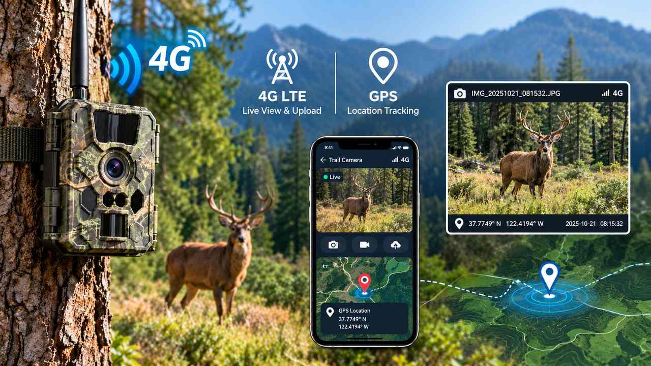
For a single camera in a known spot, location is a non-issue — you put it there, you know where it is. For a B2B deployment the math changes fast. A hundred units across farms, utility corridors, construction sites and wildlife reserves stop being "a camera" and become an asset fleet, and suddenly two questions matter: where was this picture taken, and where is my camera right now. GPS is the usual answer — but what it actually delivers, and more importantly where that location data lands, matters more than the checkbox on a spec sheet. This guide separates the three things people mean by "GPS on a trail camera", shows how it works on a cellular unit, and lays out when it earns its place in a deployment.
Most suppliers treat GPS as a single yes/no flag. In practice it covers three distinct jobs, and a buyer should specify which ones the deployment actually needs before signing the PO.
Three different things "GPS on a trail camera" can mean
- Geotagging — coordinates are stamped onto each captured event (photo or clip), answering "where was this taken?" Useful for survey evidence, mapped wildlife counts, or tagging an incident to a site.
- Device location / theft recovery — the camera reports its own position on demand or at intervals, answering "where is my unit now?" This is the anti-theft and asset-tracking function.
- Location heartbeat — a periodic position ping that confirms the unit is still where it was deployed and still reporting, answering "has anything moved or gone silent?"
A buyer who only asked for "GPS" may receive geotagging and assume they also get theft recovery; they are separate firmware behaviors. Spell out all three in the requirement.
How GPS actually works on a cellular trail camera
A trail camera does not need a cellular link to have GPS — a GNSS module grabs a fix whenever it has a view of the sky, and that fix can be attached to the event payload. The cellular connection is what makes the location useful: it is the channel that carries the coordinates off the device and into a system someone can act on. A camera that geotags a photo but has no way to transmit the tag has solved half the problem.
The differentiator for an OEM/ODM buyer is the destination of that data. On a closed vendor platform, GPS coordinates flow into the vendor's cloud and surface only inside their app. On a platform built for integration — BYO SIM, eSIM, multi-carrier, direct-to-customer S3, webhook and a self-hosted option — the same fix is delivered to your backend, your map, your rules. See Bring Your Own SIM for the connectivity side and Trail Camera API Integration for how the payload reaches your pipeline.
The GPS trap: phone-assisted tagging is not GPS
A lot of cameras marketed with "GPS" never actually carry a satellite receiver. What they do is borrow the phone's location at setup: you pair the camera over Bluetooth or Wi-Fi Direct, the phone's own GNSS drops a pin, and that one coordinate gets written into the camera's config. The camera itself cannot locate itself afterward. The result is a single install-time marker — useful for "I put it near the north fence", useless for "where is it now" or "has it moved". There is no anti-theft, no periodic report, no recovery, because the hardware was never listening to satellites.
Xlinkcam's 4G trail cameras are different in kind, not degree: they carry an actual onboard GNSS module, so the camera locates itself whenever it has sky. That single fact is what makes the three jobs above real — geotagging on every event, on-demand or scheduled device location for genuine theft recovery, and a location heartbeat that proves the unit is still where it belongs. And because it is a configurable firmware feature, the timed GPS reporting is customizable: you set the interval and the payload to match the deployment, not a fixed vendor preset.
GPS vs no-GPS: what you gain and what it costs
| Capability | With GPS | Without GPS |
|---|---|---|
| Geotag each event | Yes — coordinates in the payload | No — events are location-blind |
| Theft recovery / asset tracking | Yes — unit reports its own position | No — a stolen unit is gone |
| Location heartbeat | Yes — confirms deployment integrity | No — only image timestamps tell you anything |
| Data destination | Your backend (BYO SIM / webhook / S3 / self-hosted) | N/A |
| Battery budget | Higher — GNSS fix + transmit draw | Lower |
| Sky dependency | Needs open sky for a fix | None |
| Best fit | Multi-site fleets, theft-prone or regulated sites | Single known-location, cost-sensitive use |
When you do want GPS
GPS earns its keep the moment a deployment spans more than a handful of known sites:
- Multi-site security and jobsite monitoring — know which site an event came from, and recover units taken from unsecured locations.
- Wildlife and environmental surveys — geotagged captures turn a photo folder into mapped evidence a regulator or client can trust.
- Utility, pipeline and agricultural fleets — across hundreds of acres, a location heartbeat proves the unit is still where it should be and still alive.
- Theft-prone remote deployments — a recoverable position is the difference between a write-off and a retrieved asset.
When you can skip GPS
It is not free, and not every build needs it:
- Single-camera, known location — if you placed it and you know where, the checkbox adds cost with no upside.
- Battery-critical ultra-long-life builds — a GNSS fix plus the transmit that carries it draws from the same budget as the capture itself. On season-long, hard-to-reach units where every milliamp counts, weigh the trade carefully (see Trail Camera Battery Types).
- Privacy-mandated deployments — some sites explicitly forbid device positioning; omit it by design rather than by accident.
The honest implementation notes
GPS is not magic, and a spec sheet that says "GPS: yes" hides three real constraints a buyer should plan around:
- Sky view — a GNSS module needs open sky for a clean fix. Under dense canopy, inside a metal enclosure, or deep in a building the accuracy degrades. Mounting and housing choice matter as much as the module.
- Accuracy is meters, not centimeters — fine for "which site" or "which general area", useless for "which exact tree". Set the expectation before someone expects survey-grade precision.
- It costs battery and firmware attention — both the fix and the transmit that carries it draw power, and the report interval is a firmware decision, not a default someone else picks for you.
On the Xlinkcam 4G platform, GPS location reporting is a configurable firmware feature: the report interval and payload are defined per your deployment's firmware spec, not shipped as a fixed one-size preset. That is the honest boundary — it is supported and adapted to your requirement, not a turnkey toggle with no engineering behind it.
Where Xlinkcam fits
GPS is only as good as the link that carries it and the system that consumes it. The Xlinkcam 4G platform is built so location data stays under your control:
- True onboard GNSS, not phone-assisted tagging — the 4G camera locates itself, so theft recovery and a location heartbeat are genuine capabilities, and the timed GPS reporting is customizable to your firmware spec rather than a one-time setup pin.
- Cellular + BYO SIM / eSIM / multi-carrier — GPS reports travel over the carrier your deployment already runs on, not a locked vendor SIM.
- Direct-to-S3, webhook, REST API and self-hosted (customer AWS) — coordinates flow into your backend, your map and your alerting, not a closed app.
- OTA firmware updates — location-reporting logic can be tuned fleet-wide without a recall.
- BLE + Wi-Fi Direct offline access — a field tech can read the last-known GPS position without cellular, straight from a phone.
The result is the same pattern as the rest of the platform: the camera captures the data, and you decide where it goes. That applies across the MMS, SMTP, FTP, Cloud Storage and Live Stream families — pick the transfer path that fits the deployment, and GPS rides along on whichever one you choose. For the connectivity baseline, start with What Is a Cellular Trail Camera and the Cellular vs Wi-Fi decision guide.
Talk to us
If your deployment needs location — geotagged captures, theft recovery, or a fleet heartbeat — tell us the report interval and the destination (your S3 bucket, your webhook, your self-hosted instance) and we will spec the firmware to match. Talk to our team about a GPS-enabled OEM/ODM build.